Overview
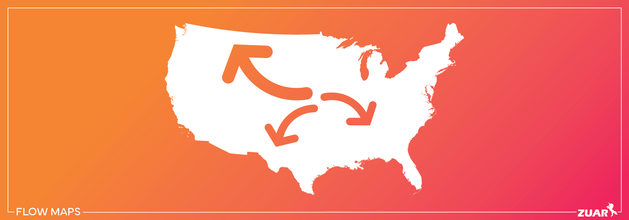
Imagine a world where complex data about movements and connections could be visually represented in a simple and digestible format. Welcome to the world of flow maps!
These powerful tools enable users to get valuable insights into the intricacies of various flows, such as traffic patterns, migrations, and trade routes, by representing the movement of elements with lines of varying width.
In this article, we will guide you through the fascinating world of flow map creation, its types, and techniques to create them, as well as real-world applications and design principles. Also, you will have a comprehensive understanding of how flow maps can be a powerful tool in your data visualization arsenal.
Key Takeaways
- Flow maps are a visual representation of the movement of elements, employing design strategies to effectively illustrate changes in various fields.
- There are three main types of flow maps - radial, distributive, and network, each with their own characteristics for different needs.
- To create effective flow maps, a solid grasp of data modeling, relationships, and Data Analysis Expressions is essential.
- Design principles such as curved lines and data flowing from left to right can help create effective flow mapping visuals that have real-world applications across multiple industries.
Check out this related article:
 Team Zuar
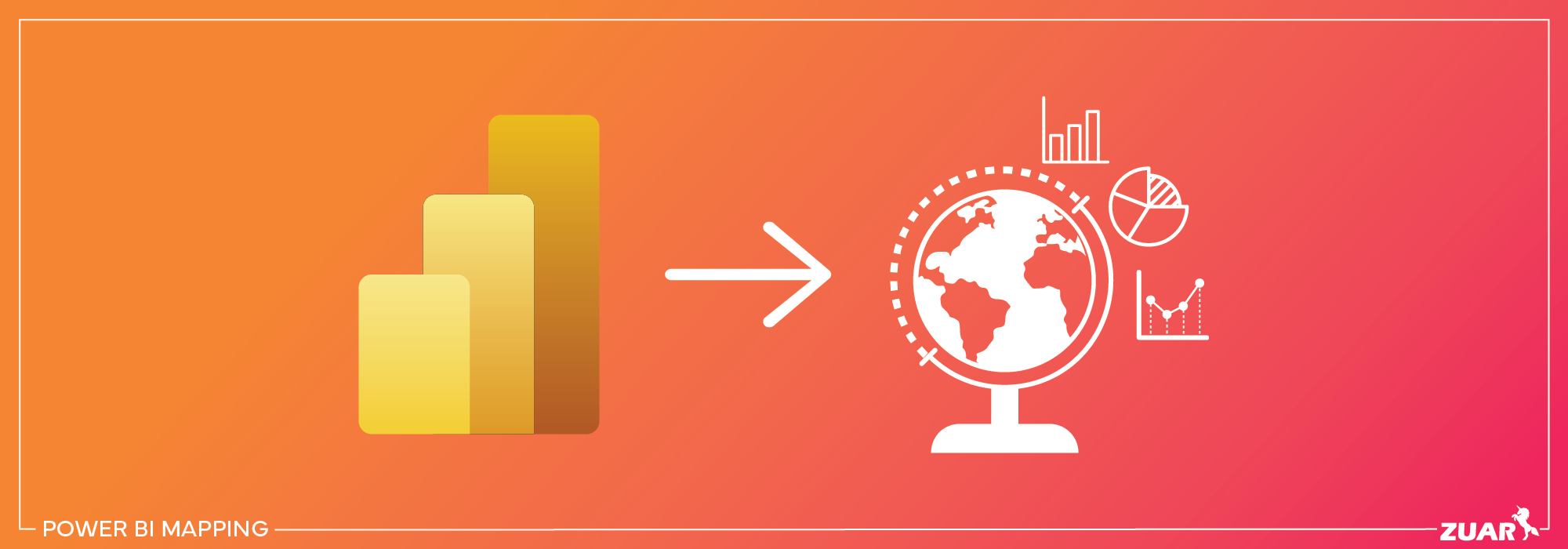

Understanding Flow Maps
Flow maps offer a visual representation of the movement of elements, such as people, goods, or information, with lines of varying width indicating the quantity or magnitude.
These maps come in various flow map designs, and their primary types include network, radial, and distribution maps.
Flow maps employ design strategies, such as proportional line widths, to effectively illustrate the movement of elements between locations.
Various fields find flow maps invaluable for depicting changes in weather, traffic patterns, and illustrating past events like military operations. Flow map designs play a crucial role in achieving this clarity and effectiveness, and a well-planned flow map layout can significantly enhance the overall presentation.
If you are using visualization tools like Power BI, understanding how to establish relationships between tables and utilizing the DAX language to create calculated columns and measures are pivotal skills in data modeling for flow maps.
Flow Lines and Their Importance
Serving as the backbone of flow maps, flow lines illustrate the direction and magnitude of movement between locations. Origin-destination flow maps and route maps are the two primary types of flow maps.
An example of a route network flow map includes a map depicting truck routes and truck traffic flows in Seattle, WA.
In contrast, origin-destination flow maps depict the start and end points of flows without delineating a specific route. Employing clear and concise visual elements, effective flow maps simplify the viewer’s comprehension of the represented data.
Thematic Maps and Flow Mapping
Thematic maps focus on specific themes or subjects, making flow mapping a type of thematic map that displays movement and connections.
Flow mapping can be either qualitative or quantitative, with qualitative data represented by uniform-width symbols showing movement and quantitative data employing lines and symbols of varying widths to indicate variations in magnitude between areas.
The Distributive Flow Lines Tool (DFLT) is a feature in ArcGIS. It enables users to generate distributive flow lines from one source to numerous destinations. This raster-based tool provides greater control over the flow lines and reduces processing time, making it a popular choice among ArcGIS users.
Securely Sharing Flow Map Visualizations
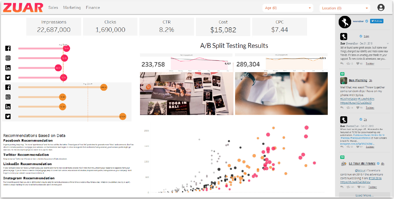
If you're looking for a secure way to share your map visualizations, as well as all other data visualizations created through Power BI, Tableau, or other platforms, look no further than Zuar Portal.
By enabling you to employ drag-and-drop simplicity, Zuar Portal allows you to create an analytics HQ for all your organization data that can be securely accessed by executives, employees, customers, and more. Learn more...


Types of Flow Maps: A Comprehensive Guide
This comprehensive guide explores the three main types of flow maps: radial, distributive, and network. Each type serves a specific purpose in representing the flow of elements, such as people, goods, or services, from one location to another, and they all have their unique characteristics.
Understanding the differences between these types of flow maps can help you choose the most suitable one for your specific needs and applications.
Radial Flow Maps
Radial flow maps illustrate the relationship between a single source and multiple destinations using separate lines radiating out from a starting point to indicate the flow of movement. These maps are useful for visualizing the flow of elements, such as goods or services, from a central location to various destinations.
For example, the United States foreign trade census data can be used in a radial flow map to showcase what, where, and how much the United States exports to other countries.
Radial flow maps offer a clear and concise way of representing the movement from one source to multiple destinations, making them an effective tool for various applications.
Distributive Flow Maps
Distributive flow maps display the flow from one source to multiple destinations with a single line that branches out into smaller lines. These maps are more effective than other types of flow maps, as they enable a more succinct visualization of the flow of something from one source to multiple destinations.
Examples of distributive flow maps include population migration maps, traffic flow maps, and trade flow maps.
Distributive flow maps provide an efficient way to visualize the movement of people, goods, or services.
Network Flow Maps
Network flow maps represent the flow of elements along existing networks, such as transportation or communication systems. Flow lines in network flow maps can be represented using line thickness and color to denote magnitude.
These maps can be used to assess transportation patterns, migration routes, and data flow within a system. By visualizing the movement of elements along networks, network flow maps serve as a beneficial tool for various applications and help users evaluate transportation patterns, migration routes, and data flow within a system.

Creating Flow Maps: Tools and Techniques
There are various tools and techniques available to create flow maps, such as the FlowMapper plugin for QGIS, ArcGIS Distributive Flow Lines Tool, and visualizing network flow with line symbols and colors.
Each of these tools and techniques offers unique capabilities and features, making it easier for users to create flow maps that effectively convey the desired information.
Understanding the variety of available tools and techniques empowers you to select the most suitable method for creating your flow map.
FlowMapper Plugin for QGIS
Designed for convenience, the FlowMapper plugin for QGIS enables users to generate flow maps, with a particular emphasis on radial flow maps.
It offers a variety of options, including the capability to personalize the look of the flow lines, as well as the option to add labels and annotations to the map. The plugin requires two text files as inputs and comes with test data that can be used as a template.
Upon running the plugin, line thickness will illustrate the magnitude of movement. The FlowMapper plugin for QGIS is a user-friendly tool that makes it easy to create radial flow maps, making it a popular choice among QGIS users.
ArcGIS Distributive Flow Lines Tool
The ArcGIS Distributive Flow Lines Tool is a feature in ArcGIS that creates distributive flow maps from a single source to multiple destination points. This tool offers a variety of features, including the capability to modify the look of the flow lines and the possibility to add labels and annotations to the map.
The ArcGIS Distributive Flow Lines Tool offers the following features:
- Swift generation of distributive flow maps
- Personalization of the line symbol used for data flow depiction
- Visualization of data flow from a single source to multiple destinations.
Be sure to check the official Power BI documentation and community forums for the most up-to-date information on using ArcGIS integration and creating flow line map visualizations.
Visualizing Network Flow with Line Symbols and Colors
Various techniques can be utilized to visualize network flow with line symbols and colors, including utilizing different line widths to signify different levels of flow and different colors to represent distinct types of flow.
For instance, a solid red line can signify a high-traffic flow, whereas a dashed blue line can indicate a low-traffic flow.
Additionally, a thicker line can represent a higher volume of flow, and a thinner line can denote a lower volume of flow.
Using line symbols and colors to visualize network flow enhances the comprehension and interpretation of data, people, or goods’ flow along established networks, thus making it an effective method for creating network flow maps.
You can use this approach to represent connections, relationships, or flows between entities, and color coding can help to highlight patterns or categories within the flow data.

Animated vs. Static Flow Maps: Pros and Cons
Flow maps can be either animated or static, with each format offering its own advantages and disadvantages.
Animated flow maps have enhanced visualization, the capability of depicting time sequences, and the ability to emphasize flows. However, they also come with drawbacks such as clutter and complexity, potential distraction, and technical limitations.
On the other hand, static flow maps offer readability, minimal distraction, and efficiency. Understanding each format’s pros and cons enables you to make an informed decision on the flow map type best suited to your needs and applications.
In summary, the choice between animated and static flow maps depends on your specific data, audience, and objectives.
If you need to show changes over time or want to engage users with a dynamic presentation, animated flow maps are a better choice. However, if your data is spatial and not time-dependent, static flow maps may be the way to go.

Design Principles for Effective Flow Maps
Effective flow maps follow specific design principles to ensure clarity and ease of interpretation. Utilizing curved lines instead of straight lines offers a more aesthetically pleasing and easier-to-comprehend visual, particularly when used with circular arcs.
Connecting each shape to other shapes facilitates a smooth progression and enhances comprehension of such a map. Good flow maps, therefore, adhere to these principles for optimal results.
Sustaining a consistent design across the map, flowing data from left to right, and keeping the map on a single page all contribute to improved readability and comprehension. The following are the steps you can use:
- Simplify and Reduce Complexity
- Use Clear and Intuitive Symbols
- Scale and Proportional Representation
- Color Coding for Meaning
- Provide a Legend and Labels
- Directional Arrows and Lines
- Interactivity and Drill-Downs
- Consistency in Styling
- Spatial Context
- Testing and User Feedback
- Consider Animation (if applicable)
- Accessibility and Responsive Design

Real-World Examples of Flow Mapping
Flow mapping has numerous real-world applications, such as in transportation planning, hydrology, and business analysis.
Examples of flow mapping in practice include recruitment and selection process flow maps, origin-destination flow maps, visualizing data ecosystems, and using flow maps as a management tool.
These real-world examples showcase the versatility and utility of flow maps in various fields and contexts, further emphasizing the importance of understanding and utilizing flow mapping techniques.

Implementing Data Visualization
Flow maps provide a powerful and versatile tool for visualizing the movement of elements, such as people, goods, or information, across various networks. The process of creating data visualizations, such as flow maps, incorporating them into dashboards, and sharing insights with stakeholders can be tedious, however.
If you're looking to jump-start your data visualization journey, consider consulting with Zuar's team of data experts. We have the experience and expertise to not only help you create beautiful data visualizations, we can help you craft a data strategy that encompasses data collection, cleansing, transformation, accessibility, and more!
Additionally, our cutting-edge platform collects data from hundreds of sources and provides secure, global access to insights across your organization.
Start crafting your data strategy today by consulting with one of our data experts!
